Welcome to stage 3 of the Kununurra Shared Loop Path (Coolibah Shared Path) project page! We are excited to progress this project aimed at enhancing connectivity and accessibility within our town centre.
Project Overview
The proposed path will provide a dedicated shared path from East Kimberley College and the library to key locations such as the Kununurra Water Playground, town centre, and Leisure Centre. This initiative is part of the broader Kununurra Shared Loop Path, which serves as the main shared path running through the Kununurra Townsite, linking strategic locations with residential areas.
The Shire received funding from the Department of Transport's Regional Bike Network Program to develop detailed designs for stage 3 and has engaged a transport engineer to design the path.
Connectivity and Purpose
The primary purpose of this path is to improve safety for children walking or cycling between the schools and the Kununurra Leisure Centre. This section is considered a primary route under the WA Cycling Network Hierarchy in the Draft Cycling Strategy Kimberley 2050, highlighting its importance in our community's active transport network.
Stage 3 Details
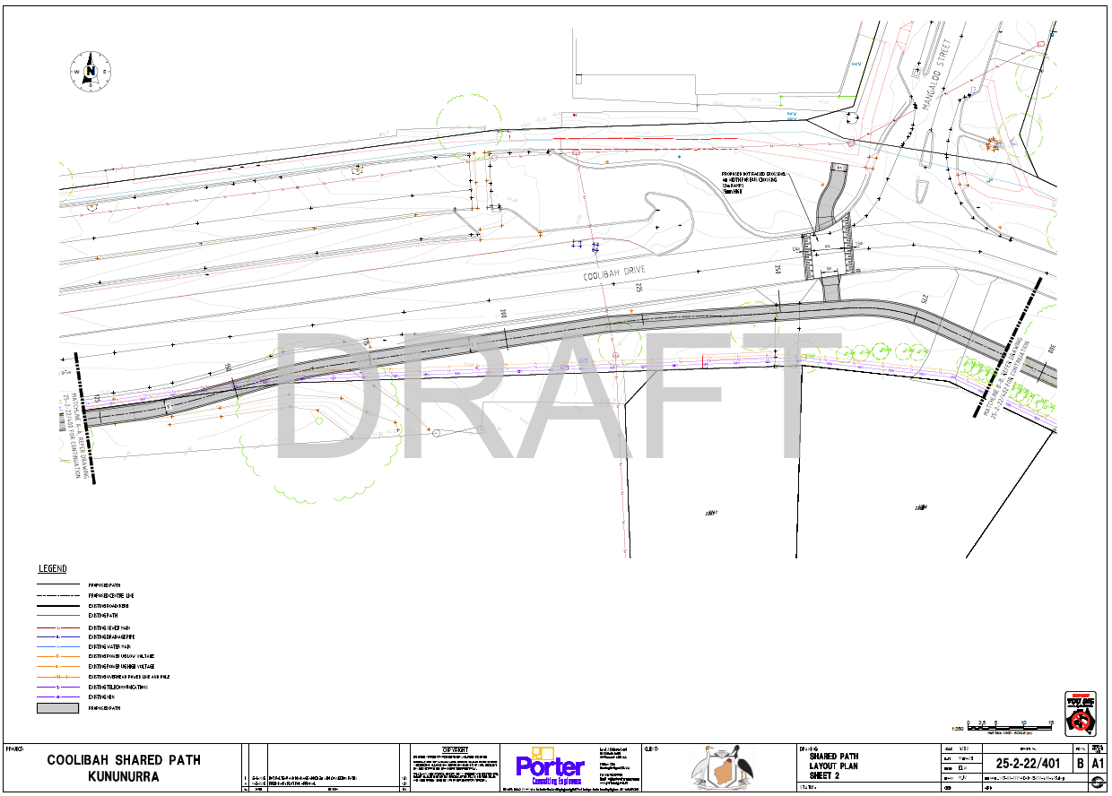
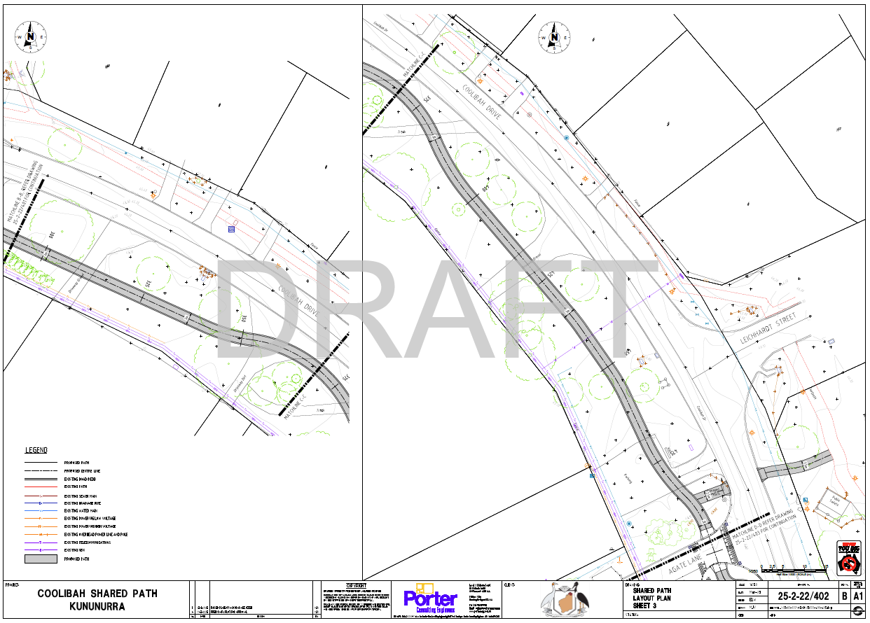
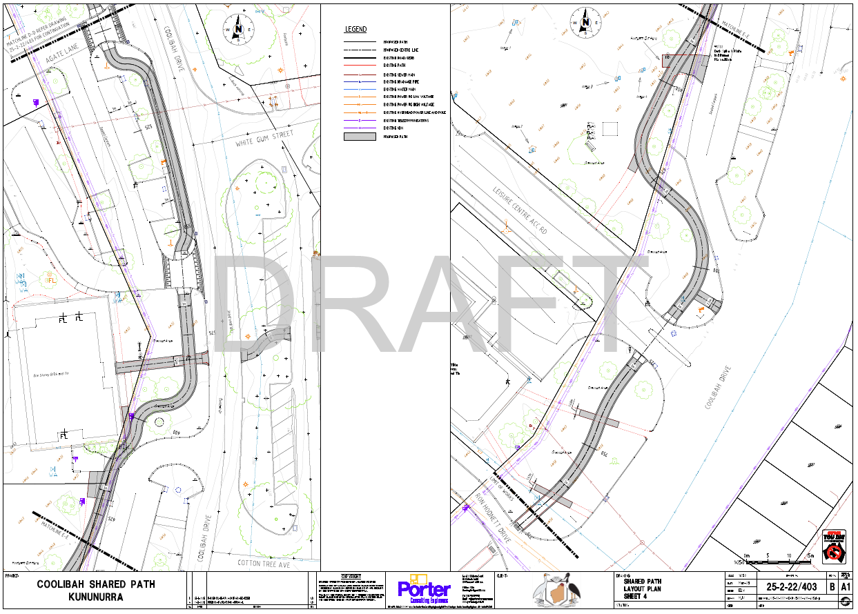
Stage 3 of the Kununurra Shared Loop Path will close the loop around Coolibah Drive, bridging the gap between the schools and the Leisure Centre. This new section will start at the Post Office where the existing path ends and continues round to the Chestnut Avenue shared path.
The proposed path will provide a more direct route from the East Kimberley College and Kununurra School and Community Library to the Kununurra Leisure Centre and reduce the number of road crossings needed. See attached connectivity map.
Enhancements and Features
In addition to the path itself, the Shire is proposing to develop landscaping along its length. This will include amenities such lighting, reticulated lawn, trees and wayfinding signage to ensure a pleasant and user-friendly experience for everyone.
We invite you to explore the connectivity map attached to see how this new path will integrate with existing routes and enhance your daily travels. Stay tuned for updates and opportunities to get involved in this exciting project!
Draft Plan
News feed
Quick Poll
What would you like to see along the new path?
This poll has concluded.


